


Here are some examples of the most common Arcoda Mobile applications:
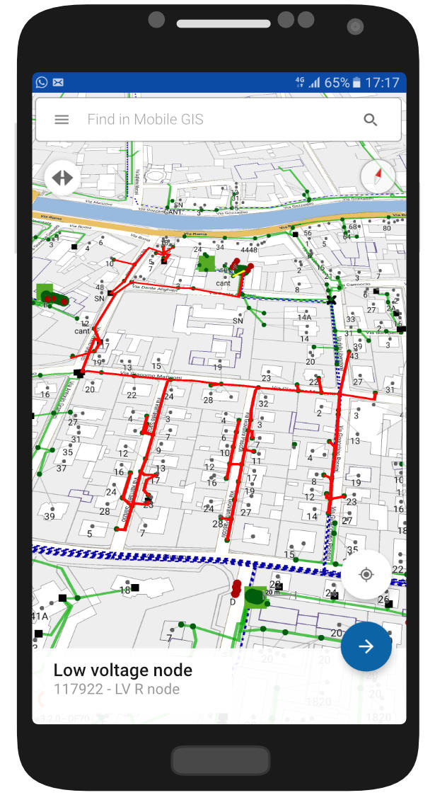
Mobile GIS is a high-end software platform, developed by Arcoda, that deploys cartography and all relevant documents on Android based smartphones and tablets used by employees in the field. Cartography - related to power networks, hydrants, gas networks, water networks - is deployed from the centre to teams in the field.

Arcoda Mobile GIS is also useful for sending warnings from the field to the managing centre. The mobile app provides specific forms that can be filled with annotations and attachments (GPS geographical coordinates, pictures, documents, screenshots). The following figure shows how these warnings reach the managing centre.

Warnings coming from the field (e.g. malfunctions of electrical panels, need for cleaning services on specific sites, dissimilarities on hardware) are sent to Arcoda Mobile GIS server as soon as possible (on the spot or when internet connection is available). This information is promptly stored on the web platform and made available to users, both on a map and in tabular form.
By means of the web portal, team managers can investigate each warning (descriptions, images with annotations, geographical coordinates etc.), and take the necessary measures. Warnings can also be provided to the company ERP.
Arcoda Mobile GIS makes the warnings GPS coordinates available to smartphones and mobile devices so as to help employees easily reach locations.
This app was designed to be used even in the absence of an internet connection. This feature ensures that the information is always available on smartphones and tablets, and that workers can carry out their work tasks regardless of any potential network failures.
Arcoda Mobile GIS is a flexible tool for uploading and representing networks with links and topological data. Links are just the physical connection between objects, while topological data show objects in a more sophisticated way, as objects are linked by their logical arrangement. If, for example, the topology on a map is an electricity network, each node of the network can be queried and it is possible to determine which nodes are powered by the node queried, and which ones supply power to it.
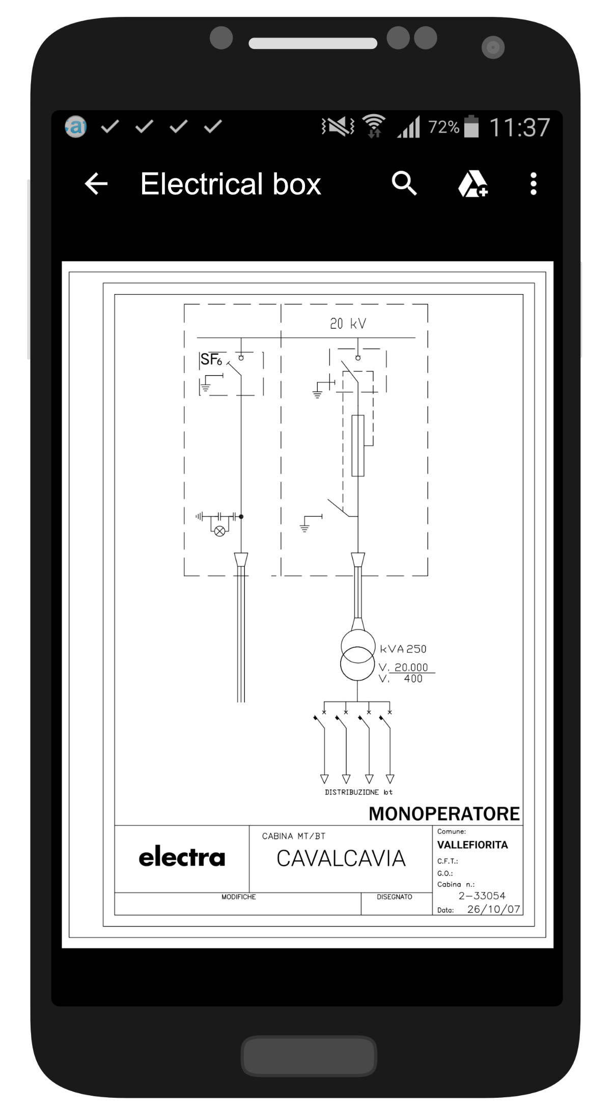
Arcoda Mobile GIS provides a tool to attach documents (images, technical descriptions, and administrative documents) to topological objects displayed on maps, making them accessible - online as well as offline - on smartphones and tablets.
Mobile GIS includes a freehand editing tool useful for drawing annotations on the images attached to the report. For example, it may be useful to point out areas on a map, or the specific parts of an electrical panel that have been photographed with the smartphone.
The Arcoda Mobile GIS search page is designed to be extremely user friendly, even on small screens. The search is fully customizable(customized search fields).
The search tool can also be customized to perform a driven search. Each search is performed by steps, and each step is driven by the previous one. For example, the search for a specific building may be accomplished by the following steps: (a) city selection - Mobile GIS search engine shows districts belonging to the selected city - (b) district selection - Mobile GIS search engine suggests streets relating to the selected district - (c) street selection - Mobile GIS search engine shows building numbers of the selected street – and so on.